CITYPLAIN: The urban and architectural solution for the design of city extensions
The massive migration to cities expected over the next 3 decades is confronting us with one of the greatest social, ecological and economic challenges on the planet, almost matched only by the scale of climate change.
Pollution, traffic, lack of resources, waste and insecurity are just some of the challenges to be faced, so it is important to look for new tools to move towards more inclusive, efficient and ecosystemic cities.
How to design the cities of the future efficiently and can they help preserve the environment?
CITYPLAIN is a technological application for the standardisation and integration of urban design processes, capable of designing affordable housing in urban districts, as well as their overall systems, taking into account functional, environmental and socio-economic indicators.
Citythinking is a consultancy focused on designing and configuring urban and architectural design platforms for the construction of residential extensions of cities in emerging countries.
This need to build affordable housing, infrastructure and systems in a massive, fast, efficient and environmentally friendly way is what motivated Citythinking to approach Plain Concepts to create together a cloud-based tool capable of designing, comparing and evaluating multiple scenarios of complete urban residential districts.
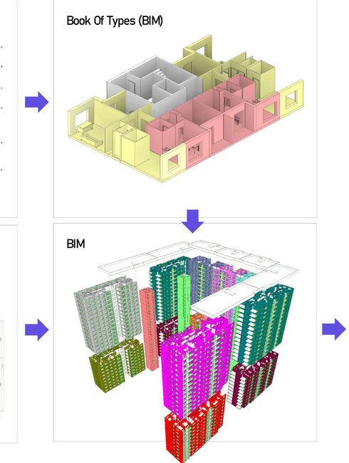
The tool had to be able to solve and technically integrate all the processes needed to design urban residential districts with respect to all environmental and socio-economic functional indicators (recognising pre-existing natural or cultural features, volumetrics, road layout).
The process
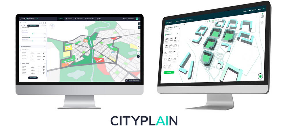
To meet the challenge, a web solution and a graphic solution were designed to allow the use of the 3D format in the browser.
The resulting application is fully compatible with Azure cloud services and is based on our Evergine cross-platform 3D engine.
The 3D graphic interface makes it possible to generate equipped urban districts quickly and easily. And the platform allows the general systems and the residential fabric of a residential urban district to be mapped out.
In addition, graphs, heat maps and a side panel with sections for configuring land use and building parameters have been incorporated.
App development with Evergine, .Net Core, Azure SQL.
3D web application for urban and architectural design.
Results
- Generation of the geometry of an arrangement, visualisation of different scenarios, different arrangements, estimation of costs, visualisation of maps.
- Design based on functional, environmental and socio-economic indicators.
- Improvement of the design and management processes of city extensions.
- Radical reduction of time and costs.
- Generation of more complex, diverse, rich, inclusive and resilient urban residential district layouts.
We are ready for new challenges